Ever wonder what your backyard looked like before development changed it dramatically. Springtown, although partially saved from intensive development, has also changed over time. The current extent of the alkali ecosystem (sink and saline drainages) is now about only 1/4 of the historic extent. (see 1958 historic image below)

We took this aerial and overlaid a recent google earth image to show the extent of change in this natural system (below).
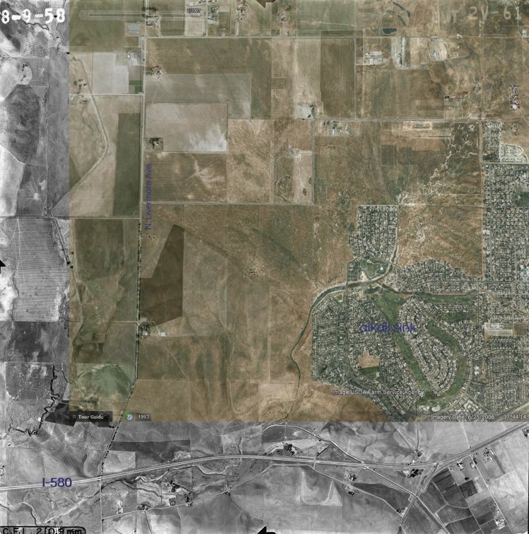
Although the images are not perfectly geo-rectified, one can fairly quickly see how much of this special habitat was destroyed. These type of images allow people of all walks and values to understand why it is so important to protect the remaining habitat.
